Kedron development moving forward with road design
North end development could be future home to as many as 22,000 people
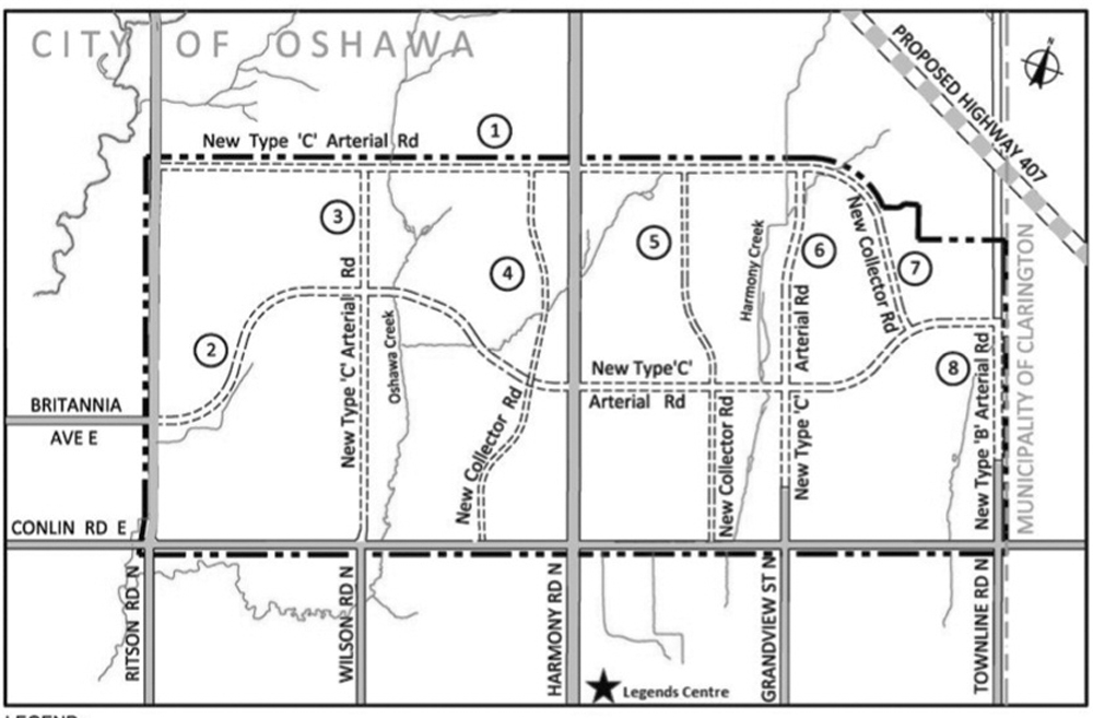
The final draft version of the road system that will feed into the newest portion of the Kedron Part II planning area. It’s estimated to be the future home of approximately 22,000 people and will include potential space for four new elementary schools, and a secondary school, along with commercial and retail spaces. (Image courtesy of GHD)
By Joel Wittnebel/The Oshawa Express
The framework for what will become one of the busiest areas of north Oshawa is nearly complete as consultants once again wrap up a round of public feedback.
Known as the Kedron Part II planning area to city officials, many in Oshawa will know the location as the vast stretch of field with a spattering of homes that dominates the area north of Conlin Road between Ritson Road and the Oshawa-Clarington boundary at Townline Road.
The development, a joint effort between a series of developers, previously passed through the public meeting phase early in 2016 with little feedback. The area could see approximately 1,500 homes, 222 town homes, over 80 semi-detached houses, more than 400 units of medium density housing and nearly 600 apartment units.
It’s estimated to be the future home of approximately 22,000 people and will include potential space for four new elementary schools, and a secondary school, along with commercial and retail spaces.
Surprisingly, this development accounts for less than half of the area designated under the Kedron Part II planning area.
The final design of the road system inside the development went before council on March 28 marking the final layout of the roads that will snake through the development. It is one of the final aspects in the Environmental Assessment process.
“This is actually a foundation piece of work that needs to inform the actual subdivision applications,” explains Paul Ralph, the city’s commissioner of development services. “This is the final wrap-up of the EA process.”
The proposed road alignments have already gone through a round of public and stakeholder feedback through a public information centre.
Following that, some adjustments were made to better position the roads to support the development and lessen the impact on the environment.
“There have been some alignment changes as a result of the public input and technical input from other agencies like the conservation authority and city staff as well,” Ralph says.
“Ultimately these will be our roads and we want to make sure they’ll be in the right location from an environmental perspective and from a cost (perspective).”
Ralph also notes that as part of the road designs, capacity for active transportation facilities like bike lanes are included, something the City of Oshawa has recently started doing, but perhaps lagged behind on in the past.
“It was like an afterthought and you come in after the subdivision was built,” Ralph says. “Now we’re doing it upfront, it’s an important part of the design of subdivision and the construction.”